- An Alliance For Community Action
- (970) 256-7650
- info@WesternColoradoAlliance.org

Celebrating Public Lands Day with a hike!
What better way to celebrate Public Lands Day than to hike through one of Colorado’s beautiful red-rock canyons with a group of new and old friends?
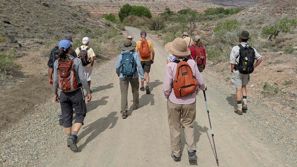
On May 15, several of us, led by Western Colorado Alliance members Lisa Eckert and Jim Riddel, hiked into Big Dominguez Canyon, a fairly new addition to our public lands located south of Grand Junction.
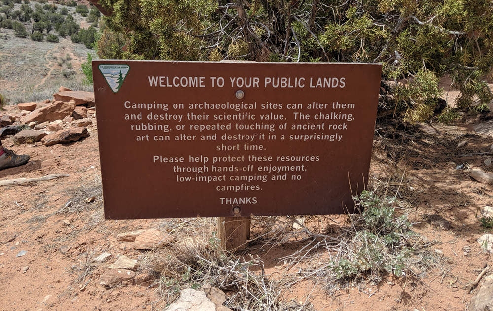
Along the way we saw towering red canyon walls, spring flowers, the full-flowing Big Dominguez Creek, waterfalls, Native pictographs, and even a bighorn sheep who watched us from a rock high above us. And we heard some good stories about the canyon’s history from fellow hikers.
Big Dominguez Canyon is part of the Dominguez Canyon Wilderness managed by the BLM. Its 66,000+ acres, which also include Little Dominguez Canyon, were added to the National Wilderness Preservation System in 2009 after many years of hard work by people who wanted to preserve it.
The Wilderness is part of the Dominguez Escalante National Conservation Area, comprising over 200,000 acres. Our group included hikers from the Grand Junction area, Ridgway, and Telluride.
We met at Bridgeport Road off Highway 50, and drove the three-mile dirt road to the trailhead on the Gunnison River. From there, we took the trail south along working railroad tracks to a footbridge, bypassing a questionable-looking ranch bridge with big “Do Not Enter” signs on it.
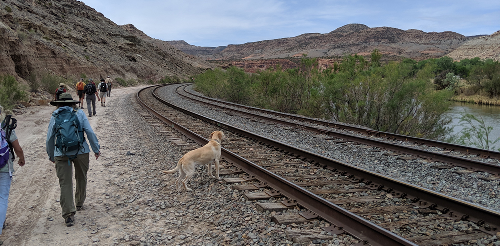
Crossing the river, we followed the Gunnison to the Dominguez Creek confluence. Turning into the canyon, we came across a group of young people happily enjoying a swimming hole at the bottom of a waterfall carved deeply into hard black rock that a member of our group said was an example of the oldest rock formation on earth.
It was working up to being a hot day, and the water looked cool and refreshing; by the end of our hike, several of us were dipping our hats into it.
About a mile up, the trail splits; to the left, Little Dominguez Canyon follows a creek to an old cabin built by Billy Rambo for his family over a hundred years ago. We turned right into Big Dominguez canyon, following the trail slightly uphill. Pretty soon we could look down onto Big Dominguez Creek from the rocky edge of a canyon-within-the-canyon; just above where we stood were a series of small falls with pools, and these were typical of the formations we saw all along the creek.
We stopped for lunch at a waterfall upstream, where we were glad for the shade and cool water and the sweet music coming from a nearby trekker playing his flute.
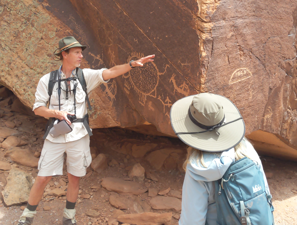
While we ate, another of our group told us stories about the canyon, like the two Fransciscan missionaries named Dominguez and Escalante who passed through the canyons in 1776 and gave the area its name. Just beyond our picnic spot, we came to a huge boulder covered with pictographs —pictures chipped into the stone by Ute Indians a few hundred years ago, or by the Fremont people over a thousand years ago, or maybe by some of both.
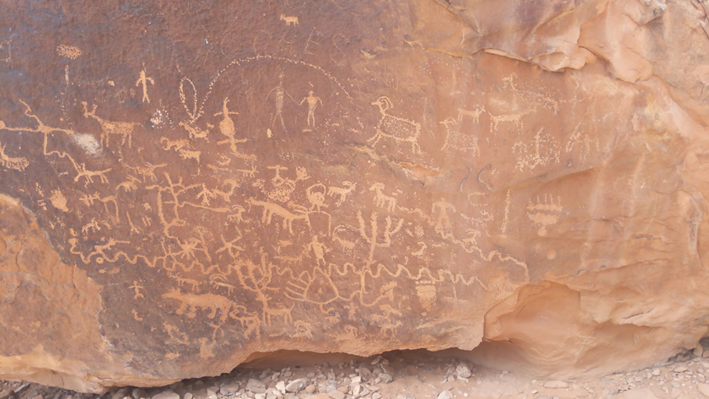
Some of the images are easy to identify — a bighorn sheep, or a bear paw. Others are mysterious. Rock faces like this, with so many images, are often called “Newspaper” rocks.
We’re fortunate here in Colorado to have access to over 22 million acres of public lands. Hiking in one of our spectacular canyons was a great way to celebrate Colorado’s fifth Public Lands Day.
Karen Rose is a Mesa County Master Gardener, a member of the Western Colorado Alliance Soil Health committee, and an avid hiker. She lives in Fruita.